 This is a picture of an Arabian Desert. It has vast sand that spreads for miles. Since there are little to no trees many sandstorms occur. Deserts also have very little water so the desert and the area around the desert get very little water per year.
 This picture shows a desert. i chose this picture because its shows that the Arabian deserts are barren, but do have life from the little rain that they get. This picture also shows a plateau which are common in the Arabian deserts.
 This is a picture of a cactus in the Arabian desert. This was an adaptation of the Arabians because with little water the Arabians had to find another source of water. Since cactus's store a lot of water in them, the Arabians would break the cactus's to get to the water.
Arabian clothing was a big adaptation in the desert because since the desert is hot and there is little to no shade people would have to cover up a lot and wear light layers so they do not over heat but stay protected from the sun

 Dams were built to help with irragation.
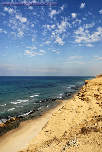
 The long spans of coast were often used as trade routs between the different teritories alon g the coast
 Oasis were so important to the enviornment because it provides water and shade in the desert.
 Oasis create vegitation in the desert.
  As a result of an oasis date trees would grow and produce many dates. Dates are a common food in Arabia.
  An adaptaion from oasis is that cactus's grow around them to collect the water.


 At the top of the mountains it was very cold and near the bottom it got hot.